 |
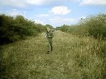
Teams at the Start.
Click on picture for enlargement
|
15 teams assembled on a fine, dry day, with perhaps a hint of autumnal chill in the air, in a small car park next to a large grassy area close to Farnborough Park in Warwickshire. As we arrived, Colin and Rosie could be seen enjoying their traditional pre-DF picnic in the middle of the grassy area - table, chairs, cool bag, plates - the only thing missing was the candles! 12.50 p.m. brought 3 good signals, station A to the West, Station B to the South-east, and station C to the North-east. Station A was quite weak, so we guessed he was right across the map, so we decided to leave him to last, therefore doing the 3 stations in the order CBA. |
|
Teams at the Start. Click on picture for enlargement |
We headed North, and at the next fixed transmission at 1.30, established that TX C was further North that we had originally thought, perhaps on a disused railway line at the edge of the map, and an idea that B was South of Banbury. As we approached the disused railway line, we could see across the field other competitors running along the bottom of the embankment. We parked up behind other competitors cars, climbed up the small bank, and hopped over the parapet onto the disused line. Phil started running towards the canal, a short distance from the railway, but I called him back, to run to where we had seen the others. There must have been a junction on the railway at that point, because there was a cutting and an embankment close together. As we ran from one to the other, we met other competitors running back, fast, and with smiles on their faces. |
|
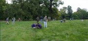
Phil running down disused railway line. Click on picture for enlargement |
A short way along the embankment was a bridge, presumably once to take the railway over a farm track. Climbing up the embankment at the side of the bridge was another competitor, having sent his team back to the car, had clocked in, and was on his way out. We knew the TX could not be far away. We all split up to search the area, with Phil going under the bridge to the other side of the embankment. Soon a shout from Phil told us that he had found the station, and we all headed back to the car. To go to Station B South of Banbury, we decided to take the A road off the map rather than weave across country on the yellow roads. Unfortunately we were blighted by lots of villages and 30 m.p.h. speed limits, so progress was painfully slow, but that in fact was to help us in a few minutes! Our start bearing and 1.30 bearing crossed just South of Banbury, and just as we were heading out of town to get a confirmation bearing, the signal came on and we stopped in a convenient turning. Phil took the bearing, which was about 180 degrees out from where we had expected it to go. I yelled to Phil to check his sense, but he was adamant that the bearing was right - and loud. We plotted the bearing, and examined the map. The bearing went through where a bridleway crossed the Oxford Canal and the River Cherwell, about a mile from where we were. We could see the bridleway went down a track for some way, so we decided to drive down the track as far as we could... |
|